
Drainage and clearing of bottomland hardwoods have long been recognized by the U.S. Environmental Protection Agency (EPA) and the U.S. Fish and Wildlife Service as important impacts of U.S. Federal water projects in the lower Mississippi River Valley. The water quality impacts of such projects (e.g., increases in sediments, nutrients, and pesticides) have also become of concern. In an effort to better define problems concerning wetland losses and water degradation, EPA initiated a cooperative project with the National Ecology Research Center of the Fish and Wildlife Service and Colorado State University. Dr. Albert Molinas was the Principal Investigator of this study for the selection, development, and testing the methods to quantify the relationships between land use, cover types, soils, hydrology, and water quality (as represented by sediment); and to the application of selected methodologies to a site within the Yazoo Basin of Mississippi to determine the potential effectiveness of various management alternatives to reduce sediment yield, increase sediment deposition, and improve water quality.
Methods development focused on linking a simulation model of water and sediment movement to a computerized geographic information system (GIS). The resulting watershed sediment routing model could:
- Estimate the importance of bottomland hardwoods as a cover type that performs the functions of erosion and sediment control
- Simulate effects of proportions of various cover types and their specific spatial configurations
- Be applicable to moderately large spatial areas with minimal site-specific calibration
- Simulate spatial patterns of sediment loss-gain over time, and
- Represent both sediment detachment and transport.
While it was recognized that impacts and management alternatives could be sorted roughly into landscape measures and channel measures, the decision was made to focus study efforts mainly on landscape measures. Landscape measures include altered drainage and flooding patterns, altered cover types (e.g., conversion of bottomland hardwoods to agricultural crops, reforestation of cropland to bottomland hardwoods, and creation of riparian buffer strips), altered cropping and tillage patterns, altered routing of water, and creation of buffer strips along wetlands and channel margins. Channel measures include vegetative bank stabilization, grade control structures, and regulation of channel water volume and velocity.
The project provided an understanding of the various modes of sediment mobilization, transport, and deposition within the Yazoo Basin, as well as of the role of bottomland hardwoods. The series of runs in which the proportion of bottomland hardwoods is changed produces a quantitative estimate of the role of bottomland hardwoods in water quality improvement in the overland runoff mode. This estimate represents a reduction in sediment loss from the landscape to the channel system of almost two orders of magnitude resulting from a potential conversion of essentially all the landscape to bottomland hardwoods. The model developed in this project can be applied to a variety of management or mitigation alternatives prior to implementation to determine their relative effectiveness. Policy, political, and socio-economic consequences of any proposed management/mitigation practice, however, must ultimately be taken into consideration by those charged with management of water resources within the Yazoo Basin before any practice is implemented.
 Effects of Bottomland Hardwoods in Sediment and Erosion Control
 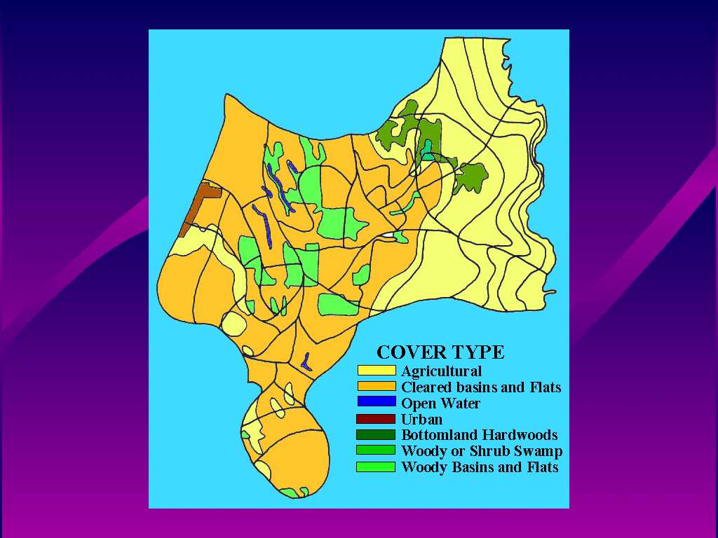 Figure 2. Cover types used in simulations
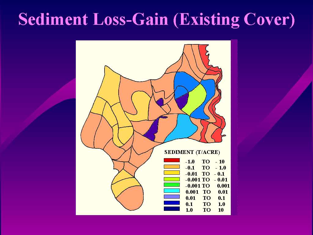 Figure 3. Spatial distribution of computed sediment loss-gain using existing land-use, cover-type, and soil types.
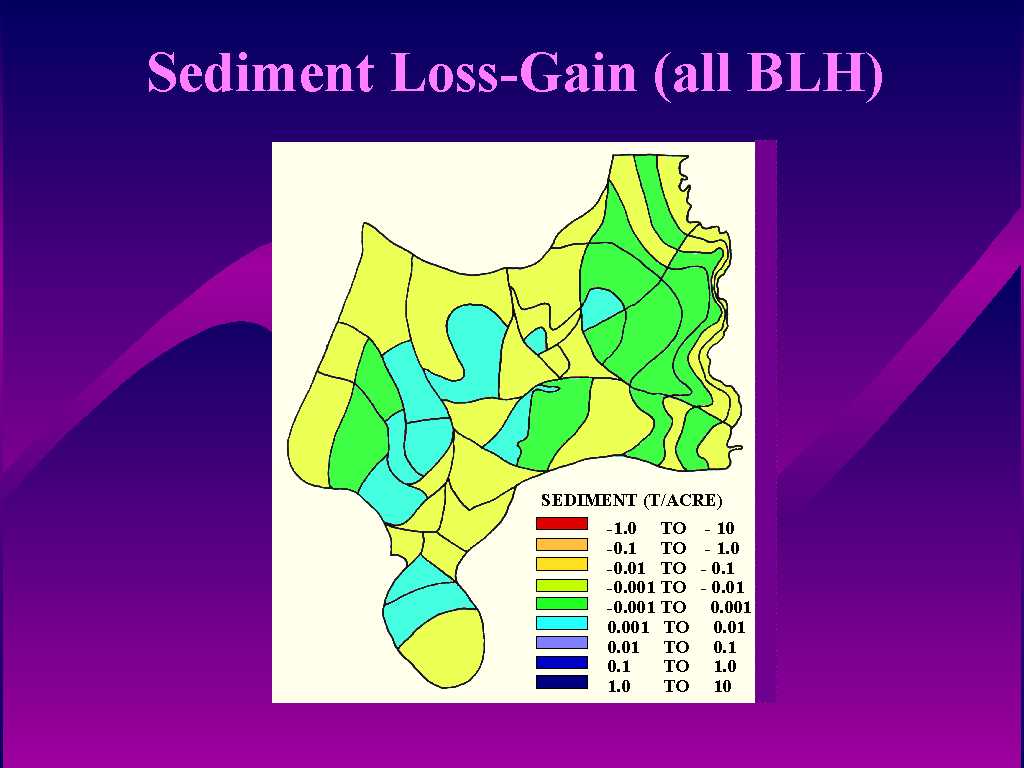 Figure 4. Spatial distribution of computed sediment loss-gain using all bottomland hardwoods.
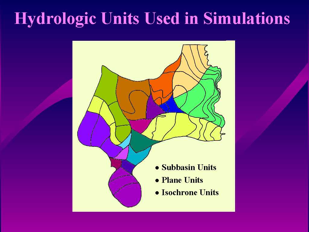
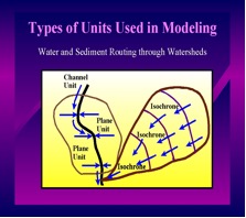 Figure 5. Watershed components used in routing water and sediment.
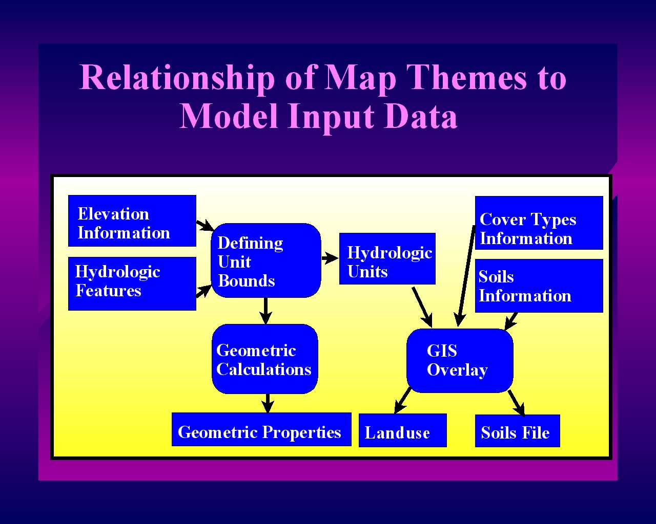 Figure 6. Linkage of GIS themes to generate input data for the watershed water and sediment routing model.
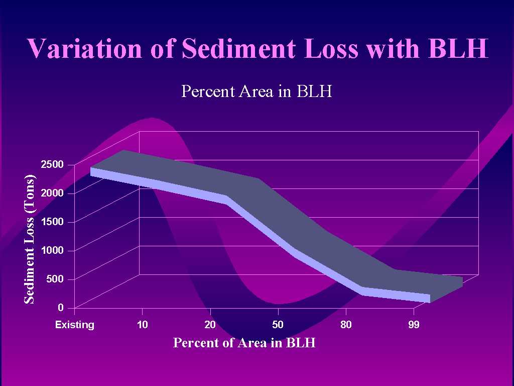 Figure 7. Summary of computer simulation runs expressing sediment loss variation as a function of percent area in bottomland hardwoods.